Agentic Workflows with Foundational Models and Geospatial Toolbelts
Overview
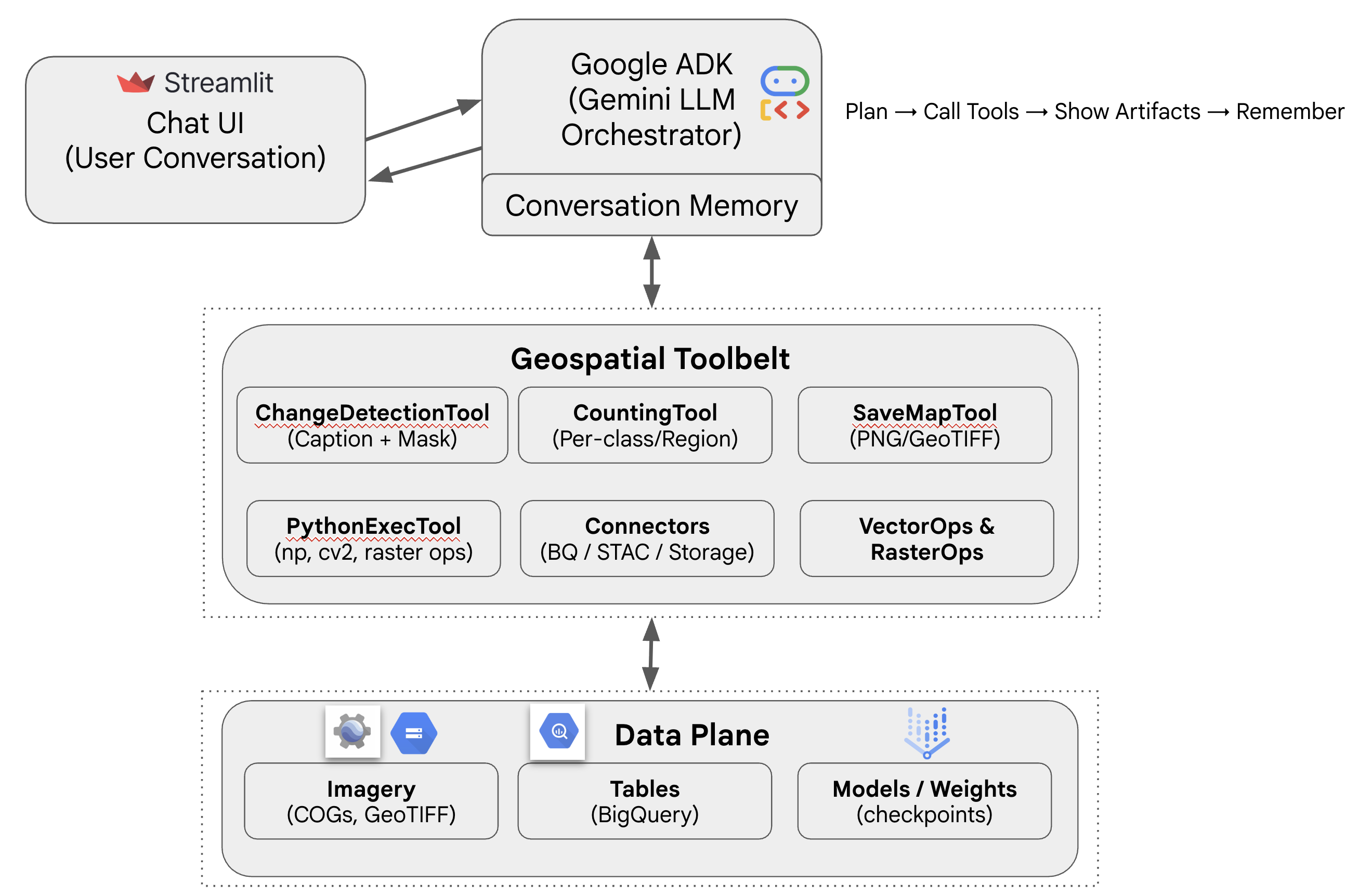
This project demonstrates how agentic workflows can orchestrate complex geospatial analysis by combining Foundational Models, custom geospatial toolsets, and Google Cloud services.
Using the Google Agent Development Kit (ADK) as the LLM orchestrator, the system interprets natural language queries, selects the right geospatial tools, and delivers outputs as maps, tables, or captions. In this example, an open-source multimodal change detection model is integrated into the workflow, producing both change masks and textual captions.
The pipeline leverages:
- Vertex AI for online model inference,
- Google Cloud Storage (GCS) for imagery and tile storage,
- BigQuery for structured/tabular data, and
- A Streamlit-based chat UI for user interaction.
Key Components
- LLM Orchestrator – Google ADK (Gemini) manages tool selection, memory, and response generation.
- Custom Geospatial Toolbelt – Tools for change detection, counting, map export, raster/vector operations, and custom Python execution.
- Cloud Services Integration – Vertex AI (inference), GCS (image storage), BigQuery (tabular/vector storage).
- User Interface – Streamlit-based chat app enabling conversational interaction and multimodal results.
Applications
- Change Detection at Scale – Captioned + masked results for monitoring land-use, urban expansion, and environmental changes.
- Conversational GeoAI – End-users can run geospatial analysis tasks with natural language queries.
- Customizable Workflows – Extendable toolbelt supports flexible geospatial pipelines (e.g., counting features, saving maps, running raster operations).
- Decision Support – Bridges foundational models and operational geospatial workflows for policy, planning, and sustainability.