Applications

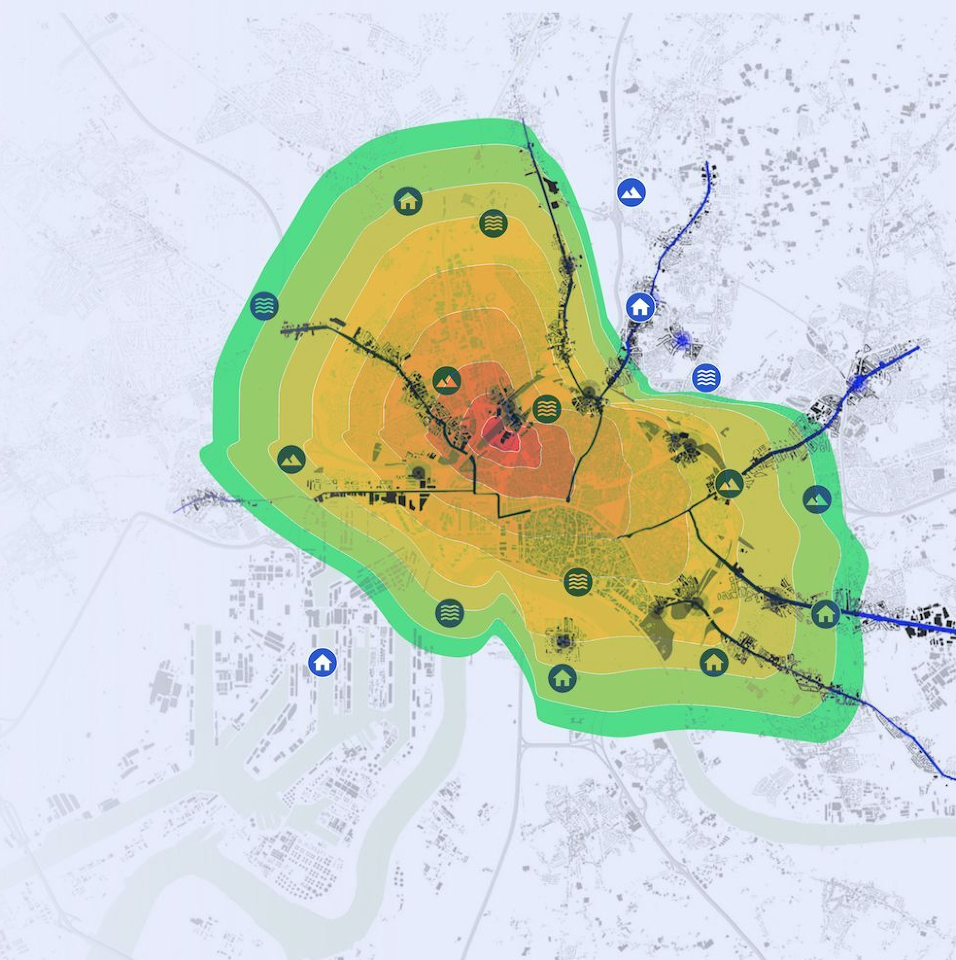
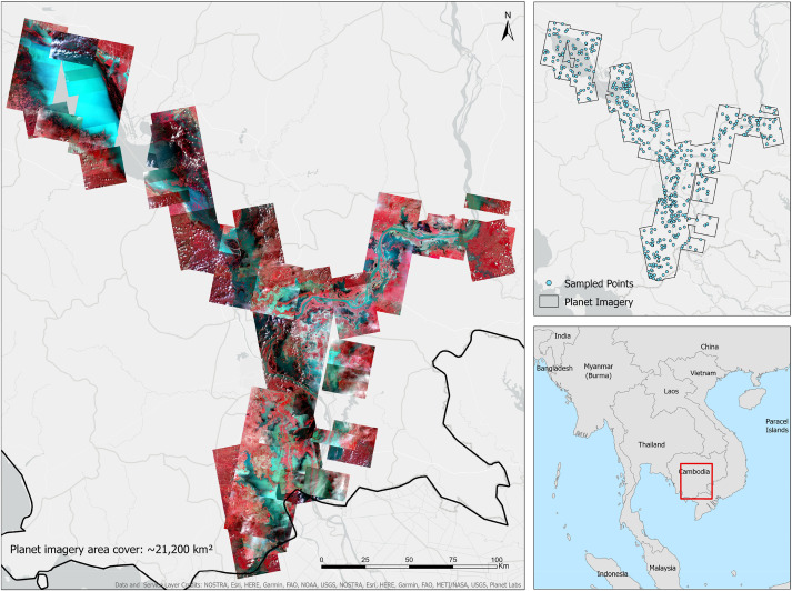
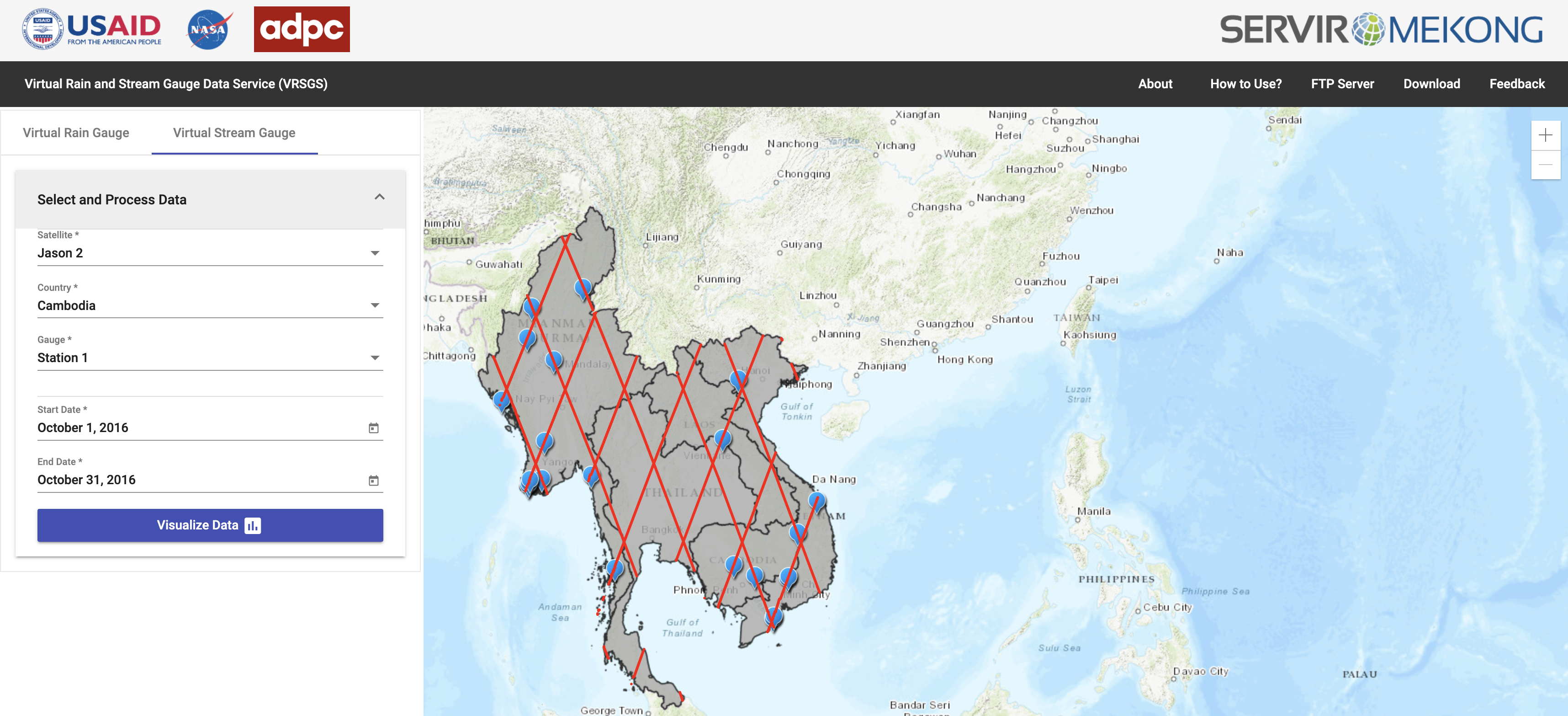
Historical Flood Analysis Tool

With this tool, variable risk for floods and potentially for droughts can be found with identification of areas particularly prone to such disasters. This information can help with preparedness for prevention and response to flood disasters.

Mekong Drought and Crop Watch

The system can be used to assist local governments and the agricultural sector with seasonal drought forecasting and in implementing short and long-term mitigation measures during and in advance of droughts.

Risk Assessment Platform

The Risk Assessment Platform is an online tool that is designed to be used to perform risk assessment using the Spatial Multi-criteria Evaluation (SMCE) method. With the facilities to upload or import datasets and creating custom criteria by defining parameters and assigning weights, the tool can be utilized in different sectors. The web application uses a powerful computational resource in the background, the Google Earth Engine, to perform spatial overlay analysis using the custom criteria set by users.

Regional Land Cover & Monitoring System

This system guides users in applying peer-reviewed methods and cloud computing power to produce a wide variety of high-quality land cover information products that can be updated regularly and consistently.

Sentiel 1 Pre-processing pipeline using Sentinel Application Platform (SNAP) Graph Processing Tool (GPT) 7.0

Using Sentinel-1 SNAP GPT to download and preprocess Sentinel 1 Radar Images, and push it to the Google Cloud Bucket to import in the Google Earth Engine (GEE). The Pre-processing included applying orbit file, thermal noise removel, border noise removal, calibration, multilook correction, radiometric terrain flattening, and DEM assisted co-registration, speckle filtering, and Range-Doppler Terrain Correction. Read more here.

Deep learning approach for Sentinel-1 surface water mapping leveraging Google Earth Engine

We investigate two methods of automatic data labeling: 1. the Joint Research Centre (JRC) surface water maps; 2. an Edge-Otsu dynamic threshold approach. We deployed a U-Net convolutional neural network to map surface water from Sentinel-1 Synthetic Aperture Radar (SAR) data and tested the model performance using different hyperparameter tuning combinations to identify the optimal learning rate and loss function. Read more here.